Tuesday, June 22, 2021
Day 15
Yesterday's travel ended in a rush to find a place to tie up for the night, despite limited visibility and heavy rain. This morning I took a picture of the spot as I pulled away.
People ask me how I deal with commercial watercraft on the river, since I'm usually in a kayak or my small sailboat. Normally the barges and towboats are not a problem since the wake (waves) they create or low frequency rollers. I simply ride over them "roller coaster style". The exception is a towboat without barges attached, like the one in the picture. They act like a bulldozer pushing a large amount of water in front of them, which results in a much larger wake than a full tow.
While on the topic of commercial traffic, the two pictures above show the front and back of the same tow. It's easy to tell all of the barges are empty because they're sitting so high in the water.
Early today I locked through Hannibal Lock and Dam. Right after I exited the lock I crossed the river to New Martinville, West Virginia. I climbed up the river bank to a ball field and saw a Walmart just a short distance away. It was a great opportunity to get gas, ice and more food.
Later in the day I made a quick stop at the Paden City Boat Ramp to get rid of my garbage. They have a nice little community park there with even a few people camping. I also met a young fellow named Ramses who himself has spent some time on the river in a kayak. He lives nearby and was interested in my boat.
With all of yesterday's rain causing a lot of things to get wet, I installed the airscoop on the front of the boat's deck. This forced air into and through the cabin as I traveled.
I passed by Marietta, Ohio. It would have been nice to stop there for a while, but felt I needed to accumulate some milage today to make up for yeaterday's shortened trip due to rain.
This isn't a very good picture, but it's where I tied up for the night. I took me an hour to get the boat backed up this far due to the mast hitting branches in the trees above. I ended up on the lower end of Vienna, West Virginia at mile 183. I covered 62 miles today.
Monday, June 21, 2021
Day 14
Welcome to the second day of this years adventure, but the fourteenth day overall. If you looked at yesterday's blog earlier today, I added several things to it when I got to an area with a better connection. I woke up at 6:00am, but wasn't able to resume travel on the river until 8:00. I passed by this tow boat and barges in the photo early, which became one of many I encountered today.
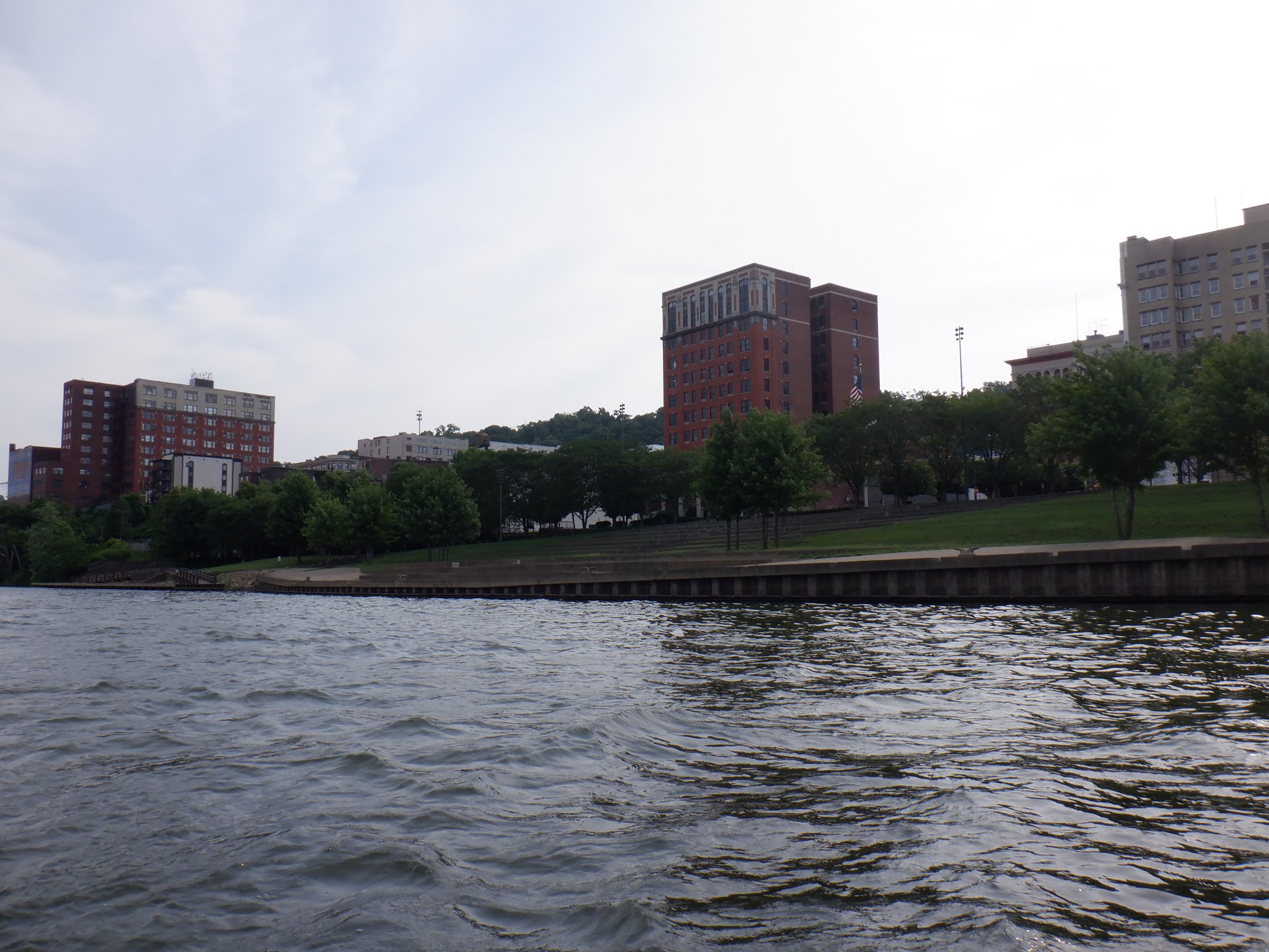
This is the river front park in Wheeling, West Virginia. It's a nice park, but my experince in the past is that there are a lot of people either drunk or mentally dusturbed hanging around. I wouldn't feel safe tying my boat to the dock and walking into town.
A Lowes on the river??? Yes, if you can figure a way up the river bank, Wheeling has a Lowes right on the edge of the river. It was a great place for me to pick up things I need for the trip.
One block from Lowes is Jebbia's Market, which is a great place for fresh fruits and vegatables.
Several hours after leaving Wheeling, I came to Moundsville. Like many of the smaller riverfront communities, they have a courtesy dock so boaters can tie up and go into town to shop. There was a Kroger store one and a half block from the dock, so I filled one of my three 2 gallon gas cans and got a few more food items.

This area is amoung the most narrow parts of the Ohio River. That narrowness, along with the winds accelerating due to the tall valleys, creates a lot of choppiness on the water surface. In this photo you can see what I was encountering for several hours. As you may have guessed, I spent much of the day soaking wet.
I'd heard on the radio that severe weather was predicted. However, it caught me off guard with rain rapidly approaching from two directions. I "beached" the boat and attempted to wait it out. WHen it let up a little bit, I continued on my way. But the rain came back again and again and again. It first started raining at 4:00. It's 10:00 in the evening as I write this and still hasn't let up.
I tied my boat up to a tree in one of the only places I could find along this part of the river. When i first tied up, there wasn't a creek next to my boat. But later I took this photo through the window and could see water rushing down the bank past my boat and into the river. Due to stopping today much earlier than planned, I only covered 36 miles. I'm tied up for the night at mile 121 across from the little community of Proctor, West Virginia.

Sunday, June 20, 2021
Day 13
Welcome to day 13 of my sailing journey on the Ohio River. If you reviewed the
"How" section of my website, you already know that days 1 through 12 were
completed last year. Due to a mechanical problem I missed about a 450 mile
section of the upper Ohio River lasy year and I'm back on the river again this
summer to complete that missing section. Yesterday my wife, Denise, and I drove
to the Mountaineer Casino, Racetrack and Resort to stay overnight before moving
a few miles down the road to Chester, West Viginia.
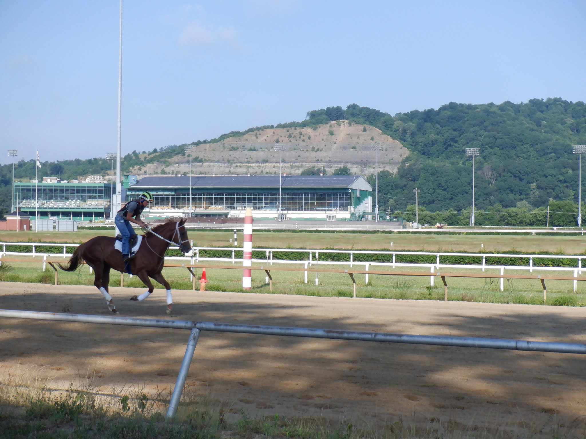
Before leaving the casino we watched the trainers working with the race horses.
Before leaving the racetrack I took a photo of my sailboat on the trailer behind
my car to give you an idea of how small it is. At fifteen feet long, my sailboat
is actually one foot shorter than my kayak I used to traveled the length of the
Ohio once before.
Upon leaving the racetrack we headed for Chester, West Virginia. Chester is the
beginning of the section of the river I skipped last year. It's also the home of
the World's Largest Teapot!
This is one of the former lock buildings from the old, old fashion locks. They're beautiful buildings and some have been restored as homes or even party/reception halls (like the one is Saylor Park, near Cincinnati).
I took this photo as I arrived in the chamber of the New Cumberland Lock and Dam. The drop in this lock was about twenty feet.
In the past I've made several attempts to travel the length of the Ohio in a kayak before finally acheving success. Each time I stopped at the community store, which is the yellow building on the right. But this time I didn't stop because the community of Stratton appears to be loosing their riverfront due to erosion.
Upon approaching Steubenville, Ohio, I took a picture of this magnificient cable-stay bridge, the Veterans Memorial Bridge.
This is where I camped out overnight. The location is right below the Pike Island Lock and Dam. Today I covered 42 miles.
Wednesday, July 29, 2020
DAY 12
Today was mainly a travel day with little opportunity for pictures or meeting people. There just is not much to do along the lowest portion of the Ohio River.
I locked through Olmstead Locks and Dam......the last of twenty lock and dams on the Ohio and the last dam from here to the Gulf of Mexico.
As I left the lock, the lock master told me it looked like I was headed toward a storm. Sure enough, dark clouds, lightening and heavy rain were headed my way. So I hooked up the tarp and tied the boat up to a tree. I must have done a much better job today because despite pretty heavy rain, I stayed dry.
The Ohio River at Cairo is designated a "fleeting area" for barges. There are literally hundreds of barges parked along both shores as well as mid river. While navigating around the barges, you have to keep an eye on the many towboats working to line the barges up in the correct order..
As I was passing along side the City of Cairo, I saw a workboat going from the public boat ramp to mid-river. They were dumping five gallon buckets of some kind of bloody looking mixture. I could even smell it. Closer to the ramp I realized I was passing through some of the stuff. It looked like the guts from slaughter pigs or cattle. From the look of the boat being used, I'm assuming this was related to the commercial fishing operation in this area. However, this scene eliminated this boat ramp as an area I wanted to stay until my son could pick me up.
As I continued onward I saw all kinds of businesses supporting the towboat industry, from dry-docks to welding to work boats.
The picture above is of my approach to "the point. The water on the left is the Mississippi River and the water on the right is the Ohio. The exact "point" is where the little red and green placard rests on shore. As I beached the boat at the point and hopped out, I sunk over a foot in the mud.
It took about thirty seconds to pull my feet out of the mud for every step. I couldl't tie up the boat, so if it has started drifting away I never would have been able to run to catch it.
This is a photo of my boat beached at the point. When I was here years ago there was a sidewalk all the way to the water's edge so people could come down right to where the rivers meet. Now you can't get within fifty feet without sinking in.
As I re-boarded my boat and pulled away from the point, I took this photo. The bridge on the left is over the Mississippi River and the one on the right is over the Ohio. Although the Ohio River is twice as wide as the Mississippi up to this point, the Ohio is still considered a tributary to the Mississippi.
I continued down the Mississippi River to a nice little community called Wickliffe, Kentucky. They have a nice boat ramp located in their community park a couple blocks from local stores. A nice gentleman by the name of Robert drove me to one of the stores so I could get drinks and food while I waited for my son to arrive for the drive home. While waiting I saw this tow going up river. Tows on the Ohio are limited to three barges wide by five barges long (because of the locks). However, with no locks on the lower Mississippi the tows can be much larger. This one was three wide by seven long......that's twenty-one barges. They were being pushed by two matching towboats.
My son arrived around 9:30pm. As we were hooking the boat to the trailer and getting things packed away, I took a picture of this varmint sitting on my boat.
Tuesday, July 28, 2020
DAY 11
I left Rondeau Island and crossed the river toward Golconda, Illinois. This is a photo of their no longer used lock master house for Dam #51. This lock house is unique because of the castle style lookout tower on the right side of this photo.
The river was very calm, punctuated only by my boat and outboard motor. I saw no pleasure craft for the first five hours and only one towboat.
I saw several beautiful houses high on hills overlooking the river valley.
The day was overcast, but I saw dark clouds moving in. As I approached Paducah, Kentucky I couldn't see their bridge because the rain was so heavy. Since the rain had not reached me yet, I beached the boat, tied up on shore and I had time to arrange a tarp over my cockpit (as I had practiced at home).
The tarp kept me relatively dry up until a towboat passed out in the main channel. I couldn't even see the towboat, but the wake came crashing against the back of the boat causing it to line up parallel to the shoreline. That meant the boat was leaning over quite a bit and subsequence waves from the wake were splashing into the boat.
Since the last time I was in this area, the City of Paducah has installed a transient ramp for boaters. It has water, electricity, a pump-out station and gas pumps. I just needed a place to tie up while I went into town and ate lunch.
The increasing width of the river is evident in the bridges. Earlier in my trip bridges may have been one, two or three spans. This bridge, down river from Paducah, is ten spans long.
This is how I tied up most evenings. A bow line (the front of the boat) is attached to an anchor pulling toward the middle of the river. A stern line (back of boat) is tied to a tree or some other anchor.
A photo of my evening view illustrates the width of the river at this point. It's more than a mile across. With only one downstream dam and virtually no development, this portion of the river is said to look much as it did when explored by Lewis & Clark. Because of the width, the water spreads out and areas become shallow; so shallow in fact that a hundred years ago farmers could walk their livestock or pull their wagons across the river. Today the shipping channel is dredged and maintained, but boats going away from the channel can be easily grounded.
Throughout the night I could hear towboats passing by on the other side of the river. By the time the wake reached me, it just gently rocked my boat. With no lights of any kind around, the lights of the towboats looked as bright and crisp as I've seen. The little blue object in the dark photo is a towboat from about a mile away.
Subscribe to:
Posts (Atom)